Schools and Satellites (SaS) is a project that aims to better quantify and understand precipitation patterns in Ghana in West Africa. Understanding precipitation patterns is critical for water management anywhere. In West Africa, rain gauges (ground-based measurements) are few and far between. Imagery from satellites (remote sensing measurements) can be used to estimate precipitation and present a potential solution; however, current precipitation estimates from satellites for the region are very inaccurate.
The goal of SaS is to use machine learning to improve these precipitation estimates from satellites; ground-based precipitation measurements from Smartphones4Water will be utilized in training and verification of the machine-learning algorithm developed. Their classic soda bottle rain gauges will be distributed to schools in Ghana, which will record local precipitation data using smartphones. You can learn more about this method of data collection here, and the accuracy of these gauges here.
For more information, please take a look at the pitch presentation that was made to win the grant. The project is granted funding by the Citizen Science and Earth Observation Lab, CSEOL.
The project will take in the 5 northern regions of Ghana: Upper West, Upper East, North East, Northern and Savannah regions, involving farmers and teachers with their students from Junior High Schools.
The project has started in August 2019 and will continue until we have been able to capture a whole rainy season with many measurement points. This was intended to happen in 2020, but due to the #CoronaCrisis, we will probably continue until the end of 2021.
Rainfall measurements taken
All collected data is open access and freely available at the database of Smartphones4Water. Please visit their platform and check out the data points. Fill in the Start to End dates, and navigate to Ghana, to see the precipitation measurements over time.
From the start, 6 great volunteers have been taking measurements of the daily rainfall and have also been testing together with us the equipment, the phone use, GPS and giving us other necessary input.
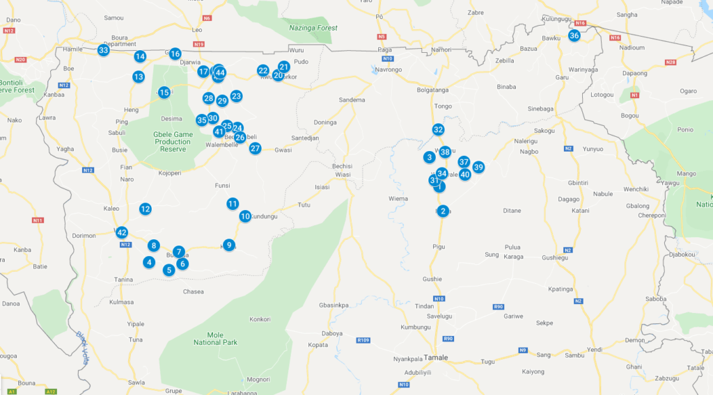
And now, in August 2020, a first roll-out has been undertaken, placing rain gauges at 44 new locations, which you can see in this map.
Rainfall measurements, for what use?
Current activities of the project
For the continuation of the project, we will make updates using newsletters, for which everyone can subscribe. Below you can see the previous newsletters that have already been send:
- First Newsletter Schools and Satellites
- Second Newsletter Schools and Satellites
- Third Newsletter School and Satellites
- Fourth Newsletter School and Satellites
- Fifth Newsletter School and Satellites ( Latest)
If you are interested to keep updated on the continuation of this project, please subscribe here to the newsletter we send out: sandra@pulsaqua.com
You can also follow us via Twitter (@SaS_Ghana) or like our Facebook page (SchoolsandSatellitesGhana).
Participating in the Schools and Satellites project
For farmers and schoolteachers in the northern regions of Ghana to participate in the SaS project, we have developed instruction materials:
- To make you own #SchoolsandSatellites rain gauge, we recommend watching this video and using the manual ‘How to make your own rain gauge’. This pdf also explains what to do.
- In the Rainfall Measurement Syllabus, we explain all the necessary steps to take rainfall measurements yourself or with your students.
- And for teachers, we have made a Teachers Manual that gives a lesson plan to teach their students about rainfall patterns, climate change and taking rainfall measurements.
- To understand how to make your own rainfall graphs, please us this instruction sheet.
We are still in the process of developing more small online video instruction material, that will be available as soon as possible. So start following the YouTube list Schools and Satellites and get an update when we have uploaded new material!


